
1980 Map of Oakland Acres
USGS Topo · Published 1980About this map
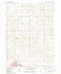
Oakland Acres and its surrounding agricultural landscape are defined by the convergence of major infrastructure and protected recreation areas. The Chicago and North Western rail line and a modern 4 Lane highway cut through the center of the sheet, providing a stark contrast to the nearby Rock Creek State Park. This park, situated around Rock Creek Lake, includes multiple Picnic Areas and a Boat Ramp, marking the area as a 1980s regional outdoor destination.
Find a feature on this map
32 named features on this map. Tap any name to fly to it.
Don’t see what you’re looking for? This feature index may not catch every label — zoom into the map to look around manually.
Map Details
Editions of this 1980 Oakland Acres Map
This is the sole edition of this map. No revisions or reprints were ever made.
Other maps of this area

1954 · Des Moines
USGS Topo · 1:250,000

1956 · Des Moines
USGS Topo · 1:250,000

1957 · Des Moines
USGS Topo · 1:250,000

1969 · Des Moines
USGS Topo · 1:250,000

1979 · Searsboro
USGS Topo · 1:24,000

1979 · Grinnell South
USGS Topo · 1:24,000

1980 · Newburg
USGS Topo · 1:24,000

1980 · Sully
USGS Topo · 1:24,000
1980 · Grinnell North
USGS Topo · 1:24,000
1980 · Alloway Creek
USGS Topo · 1:24,000