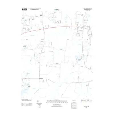
2013 Map of Oakland
USGS Topo · Published 2013About this map
Oakland and the surrounding Fayette County countryside are defined by a network of small lakes and slow-moving waterways. The landscape transition from agricultural tracts to residential expansion is evident near Hickory Withe and the Big Bell Estates development. Significant drainage and water management features, such as the Cypress Creek Canal, run alongside natural streams like Alexander Cr and Black Ankle Cr. The area is notably dotted with private and recreational water bodies including Herb Parsons Lake, Salmon Lake, and Fore Lake, each with its own associated dam. Local aviation is represented by the Pegasus Field Airport, situated centrally between the primary settlements. This rural-suburban character is further punctuated by small community nodes like Canadaville, reflecting the long-standing settlement patterns of West Tennessee before more modern subdivisions began to fill the spaces between the county roads.
Find a feature on this map
141 named features on this map. Tap any name to fly to it.
Don’t see what you’re looking for? This feature index may not catch every label — zoom into the map to look around manually.
Map Details
Editions of this 2013 Oakland Map
This is the sole edition of this map. No revisions or reprints were ever made.
Other maps of this area

1943 · Collierville
USGS Topo · 1:62,500

1949 · Moscow
USGS Topo · 1:62,500

1952 · Lambert
USGS Topo · 1:24,000

1952 · Stanton
USGS Topo · 1:62,500

1953 · Collierville
USGS Topo · 1:50,000

1954 · Mason
USGS Topo · 1:62,500

1956 · Blytheville
USGS Topo · 1:250,000

1959 · Blytheville
USGS Topo · 1:250,000

1965 · Rossville
USGS Topo · 1:24,000
1965 · Oakland
USGS Topo · 1:24,000