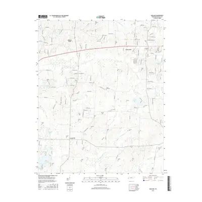
2016 Map of Oakland
USGS Topo · Published 2016About this map
The growing town of Oakland serves as the focal point for this survey of western Fayette County, showcasing a landscape where residential expansion meets traditional rural land patterns. The area is dense with family-named burial grounds, such as Rayner Cem, Mebane Cem, and Jenkins Cem, which offer significant value for genealogists tracing long-standing local lineages. This 2016 data reveals a transition from the historic unincorporated communities of Hickory Withe and Canadaville toward modern subdivisions and developed estates. Hydrological features define much of the southern and western portions, notably the recreational waters of Herb Parsons Lake and the engineered paths of the Cypress Cr Canal. The map also identifies local landmarks like Pegasus Field and various small impoundments such as Lake Tia Khata, reflecting the region's mix of private landholdings and community infrastructure.
Find a feature on this map
144 named features on this map. Tap any name to fly to it.
Don’t see what you’re looking for? This feature index may not catch every label — zoom into the map to look around manually.
Map Details
Editions of this 2016 Oakland Map
This is the sole edition of this map. No revisions or reprints were ever made.
Other maps of this area

1943 · Collierville
USGS Topo · 1:62,500

1949 · Moscow
USGS Topo · 1:62,500

1952 · Lambert
USGS Topo · 1:24,000

1952 · Stanton
USGS Topo · 1:62,500

1953 · Collierville
USGS Topo · 1:50,000

1954 · Mason
USGS Topo · 1:62,500

1956 · Blytheville
USGS Topo · 1:250,000

1959 · Blytheville
USGS Topo · 1:250,000

1965 · Rossville
USGS Topo · 1:24,000
1965 · Oakland
USGS Topo · 1:24,000