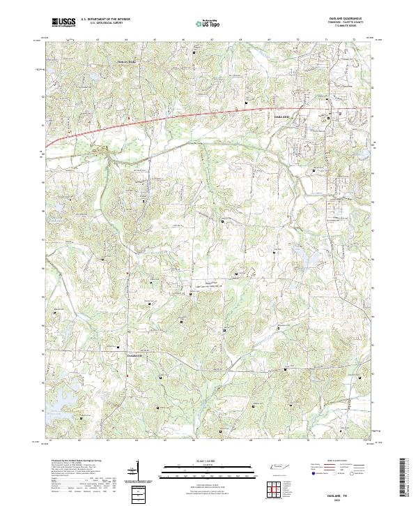
2022 Map of Oakland
USGS Topo · Published 2022About this map
The growing town of Oakland serves as a primary hub for this portion of Fayette County, situated along a busy transportation corridor that includes Highway 64. The surrounding landscape transition from the concentrated residential streets of Oakland and the older settlement at Hickory Withe to a rural expanse defined by an extraordinary concentration of family and community burial grounds. These include the Oakland Cem, Rayner Cem, and the McCulley Cem, many of which sit near the winding headwaters of Alexander Cr.
Find a feature on this map
155 named features on this map. Tap any name to fly to it.
Don’t see what you’re looking for? This feature index may not catch every label — zoom into the map to look around manually.
Map Details
Editions of this 2022 Oakland Map
This is the sole edition of this map. No revisions or reprints were ever made.
Other maps of this area

1943 · Collierville
USGS Topo · 1:62,500

1949 · Moscow
USGS Topo · 1:62,500

1952 · Lambert
USGS Topo · 1:24,000

1952 · Stanton
USGS Topo · 1:62,500

1953 · Collierville
USGS Topo · 1:50,000

1954 · Mason
USGS Topo · 1:62,500

1956 · Blytheville
USGS Topo · 1:250,000

1959 · Blytheville
USGS Topo · 1:250,000

1965 · Rossville
USGS Topo · 1:24,000
1965 · Oakland
USGS Topo · 1:24,000