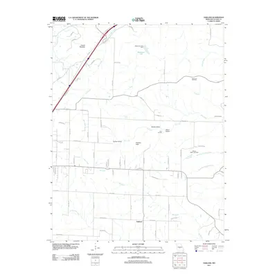
2011 Map of Oakland
USGS Topo · Published 2011About this map
Oakland and Carrol Junction anchor this part of Laclede County, where the Ozark landscape is defined by a dense network of hollows and ridges. The terrain's complexity is evident in the many named drainages such as Mill Creek, Bee Branch, and North Fork Crooked Creek, which carve through the land near Singleton Ridge. Genealogists will find the locations of the Lillard Cemetery and Jarrell Cemetery particularly useful for identifying family burial sites within these rural townships.
Find a feature on this map
71 named features on this map. Tap any name to fly to it.
Don’t see what you’re looking for? This feature index may not catch every label — zoom into the map to look around manually.
Map Details
Editions of this 2011 Oakland Map
This is the sole edition of this map. No revisions or reprints were ever made.
Other maps of this area

1933 · Stoutland
USGS Topo · 1:62,500

1938 · Stoutland
USGS Topo · 1:62,500

1941 · Lebanon
USGS Topo · 1:62,500

1943 · Richland
USGS Topo · 1:62,500

1943 · Lebanon
USGS Topo · 1:62,500

1943 · Drynob
USGS Topo · 1:62,500

1954 · Springfield
USGS Topo · 1:250,000

1954 · Drynob
USGS Topo · 1:62,500
1954 · Richland
USGS Topo · 1:62,500

1954 · Drew
USGS Topo · 1:24,000