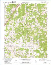
1979 Map of Oakland
USGS Topo · Published 1980About this map
The St Louis-San Francisco Railroad cuts a diagonal path through the northwestern corner of this quadrangle, defining the transportation corridor near Carrol Junction. This late 1970s landscape is characterized by a high density of rural churches and family cemeteries, including Antioch Ch, Mt Olivet Ch, and Lillard Cem, which serve the dispersed communities of Auglaize, Smith, Lebanon, and Osage townships.
Find a feature on this map
40 named features on this map. Tap any name to fly to it.
Don’t see what you’re looking for? This feature index may not catch every label — zoom into the map to look around manually.
Map Details
Editions of this 1979 Oakland Map
This is the sole edition of this map. No revisions or reprints were ever made.
Other maps of this area

1933 · Stoutland
USGS Topo · 1:62,500

1938 · Stoutland
USGS Topo · 1:62,500

1941 · Lebanon
USGS Topo · 1:62,500

1943 · Richland
USGS Topo · 1:62,500

1943 · Lebanon
USGS Topo · 1:62,500

1943 · Drynob
USGS Topo · 1:62,500

1954 · Springfield
USGS Topo · 1:250,000

1954 · Drynob
USGS Topo · 1:62,500
1954 · Richland
USGS Topo · 1:62,500

1954 · Drew
USGS Topo · 1:24,000