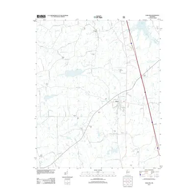
2012 Map of Oakland
USGS Topo · Published 2012About this map
Oakland serves as the central hub of this Yalobusha County landscape, where the street grid transitions into a network of rural roads such as Hickory St and Maple St. The northern edge is defined by the expansive waters of Enid Lake, while the surrounding countryside is drained by numerous winding waterways including N Fork Tillatoba Cr and Kuykendall Cr. The settlement of Blanche appears in the south, connected to the larger town by Tillatoba Co.
Find a feature on this map
96 named features on this map. Tap any name to fly to it.
Don’t see what you’re looking for? This feature index may not catch every label — zoom into the map to look around manually.
Map Details
Editions of this 2012 Oakland Map
This is the sole edition of this map. No revisions or reprints were ever made.
Other maps of this area

1932 · Philipp
USGS Topo · 1:48,000

1935 · Crowder
USGS Topo · 1:62,500

1935 · Philipp
USGS Topo · 1:62,500

1939 · Crowder
USGS Topo · 1:62,500

1939 · Philipp
USGS Topo · 1:62,500

1948 · Helena
USGS Topo · 1:250,000

1950 · Helena
USGS Topo · 1:250,000

1953 · Greenwood
USGS Topo · 1:250,000

1953 · West Point
USGS Topo · 1:250,000

1954 · Grenada
USGS Topo · 1:62,500