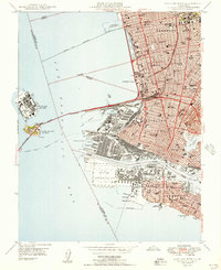
1949 Map of Oakland West
USGS Topo · Published 1949About this map
The dense industrial and residential urbanism of the East Bay is captured here just after the war, showing the intensive infrastructure connecting Berkeley, Emeryville, Oakland, and Alameda. At the heart of the maritime economy, the Oakland Mole and Pacific Overseas Depot stand as massive rail-to-ship transfer points, while the San Francisco-Oakland Bay Bridge and the electric Key System tracks carry the burgeoning post-war commuter traffic. The shoreline is a study in mid-century development, featuring the Berkeley Pier (Abandoned) stretching into the San Francisco Bay and the artificial landscape of Treasure Island adjacent to Yerba Buena Island. Significant inland landmarks range from the academic grounds of the College of the Holy Names and U C Memorial Stadium to the public space of Lakeside Park surrounding the tidal waters of Lake Merritt.
Find a feature on this map
71 named features on this map. Tap any name to fly to it.
Don’t see what you’re looking for? This feature index may not catch every label — zoom into the map to look around manually.
Map Details
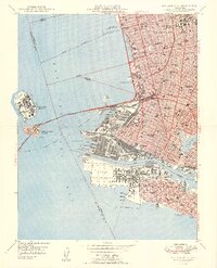
Editions of this 1949 Oakland West Map
2 editions found
Other maps of this area

1892 · San Mateo
USGS Topo · 1:62,500

1895 · San Francisco
USGS Topo · 1:62,500

1896 · San Mateo
USGS Topo · 1:62,500

1897 · Concord
USGS Topo · 1:62,500

1899 · San Francisco
USGS Topo · 1:62,500

1899 · Haywards
USGS Topo · 1:62,500

1899 · San Mateo
USGS Topo · 1:62,500

1915 · San Mateo
USGS Topo · 1:62,500

1915 · Haywards
USGS Topo · 1:62,500

1915 · Concord
USGS Topo · 1:62,500