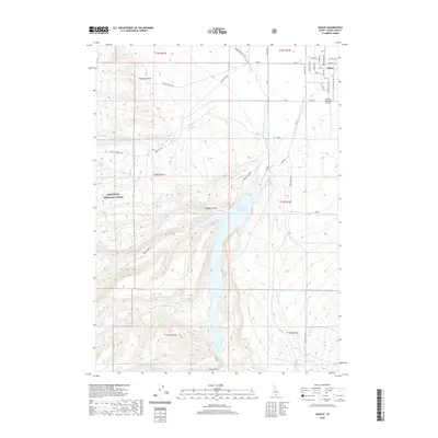
2020 Map of Oakley
USGS Topo · Published 2020About this map
The town of Oakley sits at the edge of a complex irrigation and water management system in southern Cassia County. This 2020 survey details the transition from the grid of the settlement to the desert and canyon lands to the south. The Lower Goose Creek Reservoir dominates the central landscape, fed by Goose Creek and Trapper Creek, while man-made waterways like West Canal and E Canal distribute water across the valley. To the west, the boundary of the Sawtooth National Forest marks a shift into higher elevations and named drainages such as Mackey Canyon and Walker Hollow. Local ranchers and travelers utilize a network of rural routes including Bostetter Rd and Mullen Ranch Rd, which cross the terrain near landmarks like the Oakley Municipal Airport.
Find a feature on this map
41 named features on this map. Tap any name to fly to it.
Don’t see what you’re looking for? This feature index may not catch every label — zoom into the map to look around manually.
Map Details
Editions of this 2020 Oakley Map
This is the sole edition of this map. No revisions or reprints were ever made.
Other maps of this area

1954 · Pocatello
USGS Topo · 1:250,000

1955 · Twin Falls
USGS Topo · 1:250,000

1958 · Twin Falls
USGS Topo · 1:250,000

1958 · Pocatello
USGS Topo · 1:250,000

1965 · Buckhorn Canyon
USGS Topo · 1:24,000

1968 · Basin
USGS Topo · 1:24,000
1968 · Blue Hill
USGS Topo · 1:24,000

1968 · Marion SE
USGS Topo · 1:24,000
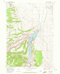
1968 · Oakley
USGS Topo · 1:24,000

1968 · Lyman Pass
USGS Topo · 1:24,000