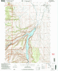
2001 Map of Oakley
USGS Topo · Published 2006About this map
Oakley stands as a focal point of irrigation and agriculture in Cassia County at the turn of the millennium. The landscape is defined by the engineering of the Lower Goose Creek Reservoir, managed by the Oakley Dam and its associated Intake Tower. This water system, complemented by the West Canal and a local aqueduct, sustains the valley floor while the western horizon is dominated by the steep canyons of the Sawtooth National Forest.
Find a feature on this map
36 named features on this map. Tap any name to fly to it.
Don’t see what you’re looking for? This feature index may not catch every label — zoom into the map to look around manually.
Map Details
Editions of this 2001 Oakley Map
This is the sole edition of this map. No revisions or reprints were ever made.
Other maps of this area

1954 · Pocatello
USGS Topo · 1:250,000

1955 · Twin Falls
USGS Topo · 1:250,000

1958 · Twin Falls
USGS Topo · 1:250,000

1958 · Pocatello
USGS Topo · 1:250,000

1965 · Buckhorn Canyon
USGS Topo · 1:24,000

1968 · Basin
USGS Topo · 1:24,000
1968 · Blue Hill
USGS Topo · 1:24,000

1968 · Marion SE
USGS Topo · 1:24,000
1968 · Oakley
USGS Topo · 1:24,000

1968 · Lyman Pass
USGS Topo · 1:24,000