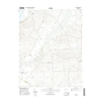
2016 Map of Oakton
USGS Topo · Published 2016About this map
Obion Creek and its many tributaries define the landscape of this Hickman County region, winding through a network of rural settlements and family cemeteries. The landscape is structured by the drainage of Bowles Creek, Cane Creek, and Hurricane Branch as they move toward the western edge of the Kentucky plateau. Near the western boundary, Chalk Bluff overlooks the Mississippi River bottoms, where Whayne Lake sits just inland from the river's current course. This 2016 survey documents the enduring layout of small communities like Oakton, Hailwell, and Whaynes Corner, which are connected by a grid of named local roads. Genealogists and local historians can locate long-standing landmarks such as Roberts Cemetery and Davis Cemetery, which remain preserved amidst the agricultural fields and creek bottoms that characterize the area west of Clinton.
Find a feature on this map
53 named features on this map. Tap any name to fly to it.
Don’t see what you’re looking for? This feature index may not catch every label — zoom into the map to look around manually.
Map Details
Editions of this 2016 Oakton Map
This is the sole edition of this map. No revisions or reprints were ever made.
Other maps of this area

1939 · Wickliffe
USGS Topo · 1:62,500

1939 · Hickman
USGS Topo · 1:62,500

1951 · Cayce
USGS Topo · 1:24,000

1951 · Oakton
USGS Topo · 1:24,000

1951 · Hickman
USGS Topo · 1:24,000

1951 · Wolf Island
USGS Topo · 1:24,000

1951 · Wickliffe SW
USGS Topo · 1:24,000

1951 · Arlington
USGS Topo · 1:24,000

1951 · Milburn
USGS Topo · 1:24,000

1952 · Clinton
USGS Topo · 1:24,000