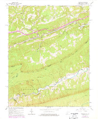
1965 Map of Oakvale
USGS Topo · Published 1978About this map
Norfolk and Western rail lines dictate the settlement patterns of this 1960s landscape, following the narrow corridors of the East River and Wolf Creek. Small mountain communities like Oakvale, Kellysville, and Willowton are concentrated along these low-lying transit routes, while the surrounding terrain is dominated by the ridges of East River Mountain and Wolf Creek Mountain. The map reveals a local economy tied to the land, featuring a Fish Hatchery near Oakvale and a Gravel Pit along the river. Social life is anchored by numerous small congregations, including New Zion Ch, Hales Chapel, and Goodwyn Chapel. Much of the southern portion of the quadrangle is preserved within the Jefferson National Forest, where the topography becomes notably more isolated, marked only by landmarks like Buckhorn Knob and the crossing at First Ford.
Find a feature on this map
54 named features on this map. Tap any name to fly to it.
Don’t see what you’re looking for? This feature index may not catch every label — zoom into the map to look around manually.
Map Details
Editions of this 1965 Oakvale Map
3 editions found
Other maps of this area

1887 · Pocahontas
USGS Topo · 1:125,000

1890 · Dublin
USGS Topo · 1:125,000

1891 · Pocahontas
USGS Topo · 1:125,000

1891 · Dublin
USGS Topo · 1:125,000

1894 · Pocahontas
USGS Topo · 1:125,000

1895 · Pocahontas
USGS Topo · 1:125,000

1913 · Peterstown
USGS Topo · 1:48,000

1913 · Bluefield
USGS Topo · 1:48,000

1916 · Bluefield
USGS Topo · 1:62,500

1916 · Peterstown
USGS Topo · 1:62,500