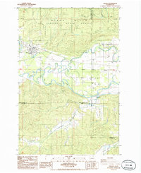
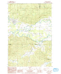
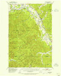
1986 Map of Oakville
USGS Topo · Published 1986About this map
The confluence of the Black River and the Chehalis River defines this landscape on the border of Grays Harbor and Thurston counties. The town of Oakville serves as a primary hub, situated just north of the Chehalis Indian Reservation boundaries. To the north, the terrain rises into the timbered slopes of the Black Hills State Forest, where drainages like Roundtree Creek and Phantom Creek carve through the upland.
Find a feature on this map
25 named features on this map. Tap any name to fly to it.
Don’t see what you’re looking for? This feature index may not catch every label — zoom into the map to look around manually.
Map Details
Editions of this 1986 Oakville Map
2 editions found
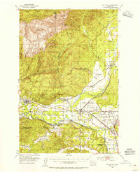
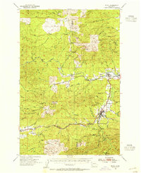
Other maps of this area

1941 · Walville
USGS Topo · 1:62,500

1941 · Meskill
USGS Topo · 1:62,500

1941 · Gate
USGS Topo · 1:62,500

1941 · Ford
USGS Topo · 1:62,500

1953 · Hoquiam
USGS Topo · 1:250,000
1953 · Rochester
USGS Topo · 1:62,500
1953 · Pe Ell
USGS Topo · 1:62,500
1953 · Malone
USGS Topo · 1:62,500
1953 · Adna
USGS Topo · 1:62,500

1957 · Hoquiam
USGS Topo · 1:250,000