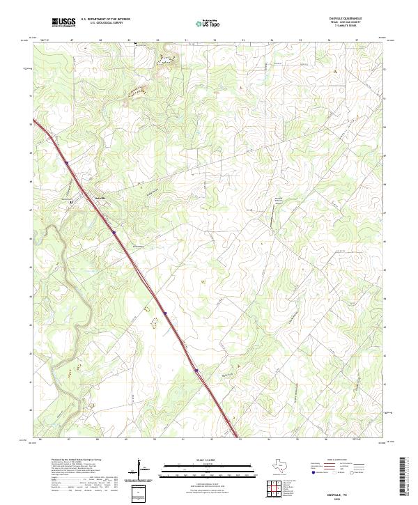
2022 Map of Oakville
USGS Topo · Published 2022About this map
The settlement of Oakville is positioned along the Nueces River in this South Texas landscape, defined by a complex network of dry washes and gullies that drain toward the river basin. The map illustrates a rural environment where modern infrastructure, like the N Hwy 37 Acc, intersects with historical sites such as Oakville Cem. To the north and east, the terrain is marked by numerous named drainage features, including Graveyard Hollow, Friday Hollow, and Valoss Gully, which speak to the area's hydrology and local nomenclature. Further inland, the presence of the Terminal D Ranch Airport and the Ray Point Cem near the northern boundary indicates the spread of ranching operations and localized family history across Live Oak County. The winding course of Sulphur Cr and the presence of Long Lake highlight the primary water sources that have historically influenced the settlement and agricultural patterns in this brush country region.
Find a feature on this map
46 named features on this map. Tap any name to fly to it.
Don’t see what you’re looking for? This feature index may not catch every label — zoom into the map to look around manually.
Map Details
Editions of this 2022 Oakville Map
This is the sole edition of this map. No revisions or reprints were ever made.
Other maps of this area

1920 · Mikeska
USGS Topo · 1:125,000

1925 · Oakville No. 4
USGS Topo · 1:48,000

1927 · Oakville
USGS Topo · 1:62,500

1936 · Pettus
USGS Topo · 1:62,500

1953 · Crystal City
USGS Topo · 1:250,000

1953 · Beeville
USGS Topo · 1:250,000

1954 · Fleming
USGS Topo · 1:62,500

1955 · Crystal City
USGS Topo · 1:250,000

1956 · Suniland
USGS Topo · 1:62,500

1956 · Beeville
USGS Topo · 1:250,000