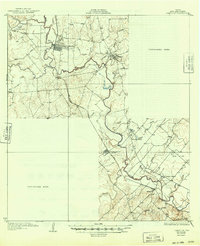
1927 Map of Oakville
USGS Topo · Published 1949About this map
The convergence of the Frio River, Atascosa River, and Nueces River anchors this 1925 survey of Live Oak County, Texas. This hydrological junction shaped the early 20th-century development of Three Rivers and George West, which served as critical transportation hubs. The landscape is defined by a dense network of water features like Pugh Marsh and numerous hollows, such as Sinclair Hollow and Graveyard Hollow, which provided drainage across the varied elevations of Big Flat.
Find a feature on this map
39 named features on this map. Tap any name to fly to it.
Don’t see what you’re looking for? This feature index may not catch every label — zoom into the map to look around manually.
Map Details
Editions of this 1927 Oakville Map
2 editions found
Other maps of this area

1920 · Mikeska
USGS Topo · 1:125,000

1925 · Oakville No. 4
USGS Topo · 1:48,000

1925 · Mathis No. 2
USGS Topo · 1:48,000

1925 · Simmons No. 1
USGS Topo · 1:48,000

1927 · Mathis
USGS Topo · 1:62,500

1927 · Oakville
USGS Topo · 1:62,500

1929 · Simmons
USGS Topo · 1:62,500

1930 · Whitsett
USGS Topo · 1:62,500

1936 · Pettus
USGS Topo · 1:62,500

1942 · Whitsett
USGS Topo · 1:62,500