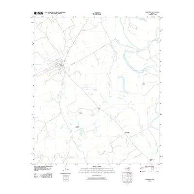
2010 Map of Oakwood
USGS Topo · Published 2010About this map
Oakwood serves as the primary hub in this corner of Leon County, where a grid of streets like Walston St transitions into a network of rural roads such as River Bend Rd. The landscape is defined by the winding course of the Trinity River and its associated oxbows and marshy lowlands, including Criminal Lake, Glaze Lake, and the Salt Water Slough. Small rural settlements and geographic markers like Sand Flats, Timesville, and Saint Paul dot the countryside, connected by farm-to-market roads and county routes.
Find a feature on this map
42 named features on this map. Tap any name to fly to it.
Don’t see what you’re looking for? This feature index may not catch every label — zoom into the map to look around manually.
Map Details
Editions of this 2010 Oakwood Map
This is the sole edition of this map. No revisions or reprints were ever made.
Other maps of this area

1951 · Elkhart
USGS Topo · 1:62,500

1953 · Palestine
USGS Topo · 1:250,000

1957 · Palestine
USGS Topo · 1:250,000

1964 · Long Lake
USGS Topo · 1:24,000

1964 · Oakwood
USGS Topo · 1:24,000

1964 · Flo
USGS Topo · 1:24,000

1964 · Keechi
USGS Topo · 1:24,000

1964 · Lake Leon
USGS Topo · 1:24,000
1964 · Butler
USGS Topo · 1:24,000

1964 · Stanmire Lake
USGS Topo · 1:24,000