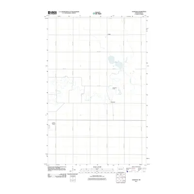
2011 Map of Oakwood
USGS Topo · Published 2011About this map
Oakwood and Cashel anchor this landscape in Walsh County, where the agricultural grid of North Dakota is intersected by the winding course of the Park River. This survey captures the region's reliance on water management and transportation, featuring the distinct Horseshoe Coulee and the saline waters of Salt Lake. The layout of the land is defined by a rigorous section-line road system, including County Rd 4 and numerous numbered avenues like 155th Ave NE. In the southwestern corner, the Grafton Municipal Airport provides a modern utility to this rural expanse. The mapping of Willow Creek as it feeds through the northern townships illustrates the natural drainage patterns that have long dictated the development and placement of settlements like Cashel along the rail and road corridors of the Red River Valley.
Find a feature on this map
21 named features on this map. Tap any name to fly to it.
Don’t see what you’re looking for? This feature index may not catch every label — zoom into the map to look around manually.
Map Details
Editions of this 2011 Oakwood Map
This is the sole edition of this map. No revisions or reprints were ever made.
Other maps of this area

1918 · Acton
USGS Topo · 1:62,500

1939 · Drayton
USGS Topo · 1:62,500

1939 · Glasston
USGS Topo · 1:62,500

1941 · Drayton
USGS Topo · 1:62,500

1941 · Glasston
USGS Topo · 1:62,500

1943 · Grafton
USGS Topo · 1:62,500

1952 · Thief River Falls
USGS Topo · 1:250,000

1956 · Thief River Falls
USGS Topo · 1:250,000

1957 · Thief River Falls
USGS Topo · 1:250,000

1960 · Grafton
USGS Topo · 1:24,000