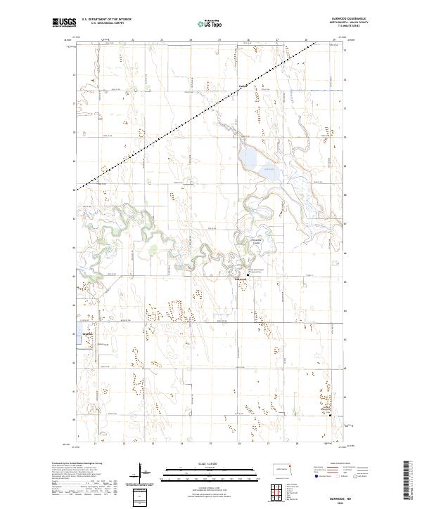
2024 Map of Oakwood
USGS Topo · Published 2024About this map
Oakwood and the winding course of the Park River define this section of the Red River Valley, where the landscape is etched by a complex network of glacial coulees and seasonal waterways. The settlement pattern follows the fertile, level terrain of the lake plain, punctuated by the sharp curves of Horseshoe Coulée and the broad basin of Salt Lake. Local genealogy and heritage are anchored at the Sacred Heart Church of Oakwood Cem and the more distant Ebenezer Evangelical Cem to the southeast. To the north, the small community of Cashel sits along the section lines, while the eastern edge of Grafton appears in the southwest corner near Hutson Field, showing the expansion of the regional hub toward the riparian woods and wetlands that characterize the drainage of Willow Creek.
Find a feature on this map
34 named features on this map. Tap any name to fly to it.
Don’t see what you’re looking for? This feature index may not catch every label — zoom into the map to look around manually.
Map Details
Editions of this 2024 Oakwood Map
This is the sole edition of this map. No revisions or reprints were ever made.
Other maps of this area

1918 · Acton
USGS Topo · 1:62,500

1939 · Drayton
USGS Topo · 1:62,500

1939 · Glasston
USGS Topo · 1:62,500

1941 · Drayton
USGS Topo · 1:62,500

1941 · Glasston
USGS Topo · 1:62,500

1943 · Grafton
USGS Topo · 1:62,500

1952 · Thief River Falls
USGS Topo · 1:250,000

1956 · Thief River Falls
USGS Topo · 1:250,000

1957 · Thief River Falls
USGS Topo · 1:250,000

1960 · Grafton
USGS Topo · 1:24,000