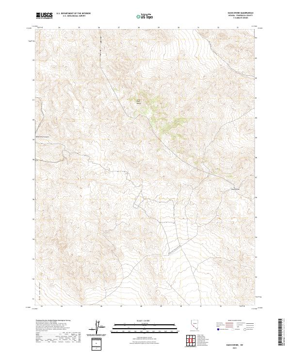
2021 Map of Oasis Divide
USGS Topo · Published 2021About this map
The Silver Peak Range dominates this landscape, offering a look at the high-elevation basin and range topography typical of Esmeralda County. The namesake Oasis Divide serves as a critical topographic saddle, with the Silver Peak-Oasis Divide Rd providing the primary passage through these arid heights. To the west, the terrain drops away into the Fish Lake Valley, while the north-central portion of the map is defined by the sharp descent of White Wolf Canyon. This survey captures the sparse infrastructure of the modern era, focusing on the essential primitive road networks like McAfee Rd that navigate the varied elevations of the Great Basin.
Find a feature on this map
10 named features on this map. Tap any name to fly to it.
Don’t see what you’re looking for? This feature index may not catch every label — zoom into the map to look around manually.
Map Details
Editions of this 2021 Oasis Divide Map
This is the sole edition of this map. No revisions or reprints were ever made.
Other maps of this area

1898 · Silver Peak
USGS Topo · 1:125,000

1900 · Silver Peak
USGS Topo · 1:125,000

1908 · Lida
USGS Topo · 1:250,000

1913 · Lida
USGS Topo · 1:250,000

1954 · Goldfield
USGS Topo · 1:250,000

1955 · Goldfield
USGS Topo · 1:250,000

1957 · Magruder Mtn
USGS Topo · 1:62,500

1958 · Goldfield
USGS Topo · 1:250,000

1958 · Soldier Pass
USGS Topo · 1:62,500

1962 · Goldfield
USGS Topo · 1:250,000