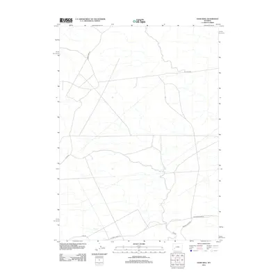
2012 Map of Oasis Well
USGS Topo · Published 2012About this map
The California-Oregon Trl cuts across the southern portion of this landscape, marking a historic corridor of western migration through Sweetwater County. This 2012 survey by the U.S. Geological Survey documents a high-desert environment where drainage patterns like Slate Cr define the topography. The map reveals a modern network of access routes that follow the natural contours of the land, including Reardon Draw Rd and Monument Butte Rd. These roads suggest a landscape primarily utilized for resource management and ranching, with B L M 4205 Rd indicating federal land oversight. The convergence of historical trails and contemporary utility roads like Hunt Rd and Steed Rd provides a clear view of how transit patterns have evolved while adhering to the same geographic constraints over time.
Find a feature on this map
8 named features on this map. Tap any name to fly to it.
Don’t see what you’re looking for? This feature index may not catch every label — zoom into the map to look around manually.
Map Details
Editions of this 2012 Oasis Well Map
This is the sole edition of this map. No revisions or reprints were ever made.
Other maps of this area

1955 · Preston
USGS Topo · 1:250,000

1955 · Lander
USGS Topo · 1:250,000

1958 · Lander
USGS Topo · 1:250,000

1958 · Preston
USGS Topo · 1:250,000

1961 · Lander
USGS Topo · 1:250,000

1962 · Preston
USGS Topo · 1:250,000
1968 · Monument Butte NE
USGS Topo · 1:24,000

1968 · Anderson Canyon
USGS Topo · 1:24,000
1968 · Monument Butte
USGS Topo · 1:24,000

1969 · Oasis Well
USGS Topo · 1:24,000