
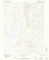
1968 Map of Anderson Canyon
USGS Topo · Published 1971About this map
The Emigrant Trail (Sublette Cutoff) traces a diagonal path across this high-desert landscape, marking a vital historical corridor for westward travelers in the Lincoln and Sweetwater County borderlands. Surveyed in the late 1960s, the terrain is defined by deep drainage systems including Steed Canyon, Delaney Canyon, and the sprawling Anderson Canyon. The map reveals a transition toward modern industrial use with several Drill Hole sites and water resources like Little Colorado Well No 6 and Little Colorado Well No 5. Transportation in this era relied on a network of rugged paths, such as the Colorado Road and various Jeep Trail segments, reflecting the intersection of historic migration routes with mid-century resource exploration in the Wyoming interior.
Find a feature on this map
12 named features on this map. Tap any name to fly to it.
Don’t see what you’re looking for? This feature index may not catch every label — zoom into the map to look around manually.
Map Details
Editions of this 1968 Anderson Canyon Map
This is the sole edition of this map. No revisions or reprints were ever made.
Other maps of this area

1955 · Preston
USGS Topo · 1:250,000

1955 · Lander
USGS Topo · 1:250,000

1958 · Lander
USGS Topo · 1:250,000

1958 · Preston
USGS Topo · 1:250,000

1961 · Lander
USGS Topo · 1:250,000

1962 · Preston
USGS Topo · 1:250,000

1968 · Fontenelle Reservoir SE
USGS Topo · 1:24,000

1968 · Names Hill
USGS Topo · 1:24,000

1968 · Fontenelle Reservoir SW
USGS Topo · 1:24,000
1968 · Blue Forest
USGS Topo · 1:24,000