
1968 Map of Fontenelle Reservoir SE
USGS Topo · Published 1971About this map
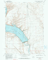
Fontenelle Reservoir dominates this high-desert landscape in southwestern Wyoming, where the waters of the Green River are captured behind the Fontenelle Dam. This late 1960s survey documents the early years of the reservoir, marking the powerplant and various infrastructure points like the Gaging Sta. Along the eastern bank of the river just below the dam, the small Whitman Cem remains a quiet touchpoint for local genealogy. To the northwest, the terrain rises sharply into Knife Canyon, contrasting with the managed water levels of the basin. The map records the utility of the land during this period of resource development, noting several Gravel Pits and a Picnic Area for recreation. The boundary between Lincoln and Sweetwater counties cuts directly through the river valley, marking a jurisdictional division in this sparsely settled region.
Find a feature on this map
13 named features on this map. Tap any name to fly to it.
Don’t see what you’re looking for? This feature index may not catch every label — zoom into the map to look around manually.
Map Details
Editions of this 1968 Fontenelle Reservoir SE Map
2 editions found
Other maps of this area

1954 · Ogden
USGS Topo · 1:250,000

1954 · Rock Springs
USGS Topo · 1:250,000

1955 · Preston
USGS Topo · 1:250,000

1955 · Lander
USGS Topo · 1:250,000

1958 · Lander
USGS Topo · 1:250,000

1958 · Ogden
USGS Topo · 1:250,000

1958 · Rock Springs
USGS Topo · 1:250,000

1958 · Preston
USGS Topo · 1:250,000

1960 · Ogden
USGS Topo · 1:250,000

1961 · Lander
USGS Topo · 1:250,000