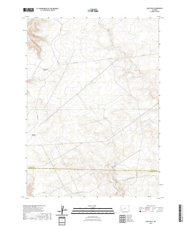
2021 Map of Oasis Well
USGS Topo · Published 2021About this map
California-Oregon Trl cuts across this high-desert landscape in southwestern Wyoming, marking the intersection of the historic West and modern resource management. The terrain is defined by deep draws and canyons, most notably Figure Four Canyon and Buckhorn Canyon, which score the plateau north of the Sublette and Sweetwater county line. This 2021 survey reveals a landscape where historical overland routes are shadowed by an extensive Bureau of Land Management road network, including BLM Rd 4202 and BLM 4205 Rd. Water is the critical scarcity here, anchored by the namesake Oasis Well and the intermittent drainage of Slate Cr. The map provides a detailed view of the modern grid of sections and townships that organize this remote territory, from Monument Butte Rd to the southern reaches near Steed Rd.
Find a feature on this map
17 named features on this map. Tap any name to fly to it.
Don’t see what you’re looking for? This feature index may not catch every label — zoom into the map to look around manually.
Map Details
Editions of this 2021 Oasis Well Map
This is the sole edition of this map. No revisions or reprints were ever made.
Other maps of this area

1955 · Preston
USGS Topo · 1:250,000

1955 · Lander
USGS Topo · 1:250,000

1958 · Lander
USGS Topo · 1:250,000

1958 · Preston
USGS Topo · 1:250,000

1961 · Lander
USGS Topo · 1:250,000

1962 · Preston
USGS Topo · 1:250,000
1968 · Monument Butte NE
USGS Topo · 1:24,000

1968 · Anderson Canyon
USGS Topo · 1:24,000
1968 · Monument Butte
USGS Topo · 1:24,000

1969 · Oasis Well
USGS Topo · 1:24,000