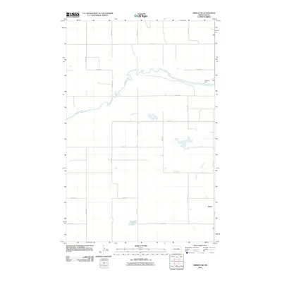
2011 Map of Oberon SW
USGS Topo · Published 2011About this map
The Sheyenne River winds across this section of North Dakota, cutting through the prairie landscape where the Sheyenne Dam regulates the water's flow. This area is characterized by its organized grid of section-line roads, including 31st St NE and 65th Ave NE, which reflect the late-20th-century development of the region's rural infrastructure. The settlement of Divide sits in the southeast corner of the map, serving as a landmark in a territory largely defined by the agricultural layout of the Crow Hill District. Smaller water bodies like Shroyer Lake and several unnamed seasonal basins dot the terrain, illustrating the hydrologic character of the northern plains. The map preserves the exact placement of local roads and natural boundaries as they existed during this 2011 survey.
Find a feature on this map
19 named features on this map. Tap any name to fly to it.
Don’t see what you’re looking for? This feature index may not catch every label — zoom into the map to look around manually.
Map Details
Editions of this 2011 Oberon SW Map
This is the sole edition of this map. No revisions or reprints were ever made.
Other maps of this area

1931 · Oberon
USGS Topo · 1:62,500

1932 · Flora
USGS Topo · 1:62,500

1948 · New Rockford
USGS Topo · 1:62,500

1948 · Cathay
USGS Topo · 1:62,500

1949 · Munster
USGS Topo · 1:24,000

1950 · New Rockford
USGS Topo · 1:24,000

1950 · New Rockford NE
USGS Topo · 1:24,000

1950 · Oberon SW
USGS Topo · 1:24,000

1950 · Sheyenne
USGS Topo · 1:24,000

1950 · Oberon
USGS Topo · 1:62,500