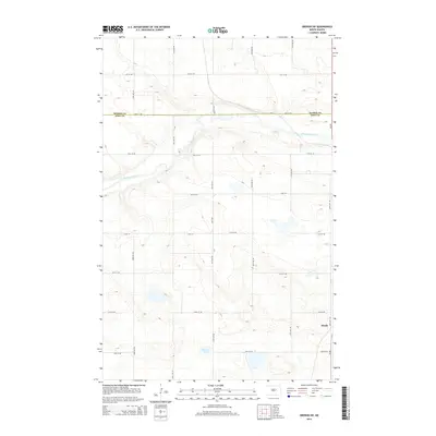
2014 Map of Oberon SW
USGS Topo · Published 2014About this map
The Sheyenne River winds through the northern portion of this landscape, carving a distinct valley across the high plains of North Dakota. In the southeast, the small settlement of Divide sits near the intersection of Us-281 and several section-line roads, marking a historic point of local navigation. This 2014 survey documents the enduring township-and-range grid, where routes like 30th St NE and 65th Ave NE define the agricultural and residential layout. The boundary between Benson Co and Eddy Co runs horizontally through the center of the sheet, while Shroyer Lake provides a notable natural landmark in the southern reaches. The map illustrates a rural area shaped by its watercourses and a rigid infrastructure of numbered avenues and streets that facilitate movement across the prairie.
Find a feature on this map
21 named features on this map. Tap any name to fly to it.
Don’t see what you’re looking for? This feature index may not catch every label — zoom into the map to look around manually.
Map Details
Editions of this 2014 Oberon SW Map
This is the sole edition of this map. No revisions or reprints were ever made.
Other maps of this area

1931 · Oberon
USGS Topo · 1:62,500

1932 · Flora
USGS Topo · 1:62,500

1948 · New Rockford
USGS Topo · 1:62,500

1948 · Cathay
USGS Topo · 1:62,500

1949 · Munster
USGS Topo · 1:24,000

1950 · New Rockford
USGS Topo · 1:24,000

1950 · New Rockford NE
USGS Topo · 1:24,000

1950 · Oberon SW
USGS Topo · 1:24,000

1950 · Sheyenne
USGS Topo · 1:24,000

1950 · Oberon
USGS Topo · 1:62,500