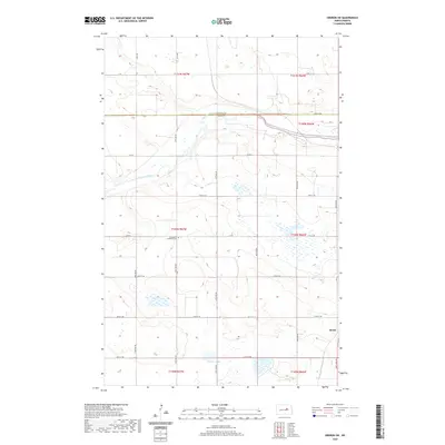
2020 Map of Oberon SW
USGS Topo · Published 2020About this map
Sheyenne River meanders across this rural North Dakota landscape, marking the boundary between Benson and Eddy counties. The terrain is defined by the glacial geography of the northern plains, featuring numerous wetlands and depressions. The Grandfield Lutheran Cem stands as a focal point for local genealogical research, situated among a network of section-line roads like Co Rd 7 and 26th St NE. To the south, Shroyer Lake and the topographic high point known as Divide illustrate the subtle but significant drainage patterns that shaped early settlement and agricultural development in the region.
Find a feature on this map
20 named features on this map. Tap any name to fly to it.
Don’t see what you’re looking for? This feature index may not catch every label — zoom into the map to look around manually.
Map Details
Editions of this 2020 Oberon SW Map
This is the sole edition of this map. No revisions or reprints were ever made.
Other maps of this area

1931 · Oberon
USGS Topo · 1:62,500

1932 · Flora
USGS Topo · 1:62,500

1948 · New Rockford
USGS Topo · 1:62,500

1948 · Cathay
USGS Topo · 1:62,500

1949 · Munster
USGS Topo · 1:24,000

1950 · New Rockford
USGS Topo · 1:24,000

1950 · New Rockford NE
USGS Topo · 1:24,000

1950 · Oberon SW
USGS Topo · 1:24,000

1950 · Sheyenne
USGS Topo · 1:24,000

1950 · Oberon
USGS Topo · 1:62,500