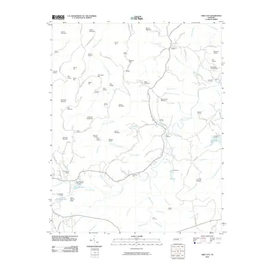
2010 Map of Obey City
USGS Topo · Published 2010About this map
West Fork Obey River and its numerous tributaries, such as Lick Hollow Branch and Sunk Cane Branch, define the topography of this Tennessee landscape. The area is marked by significant elevation changes, ranging from France Mountain and Brushy Mountain in the north to the distinctive Laboring Backbone ridge. The settlement pattern is characterized by scattered family-named hollows and flats, including Wilson Hollow and Thompson Flat, which reflect the long-standing community roots in the region.
Find a feature on this map
120 named features on this map. Tap any name to fly to it.
Don’t see what you’re looking for? This feature index may not catch every label — zoom into the map to look around manually.
Map Details
Editions of this 2010 Obey City Map
This is the sole edition of this map. No revisions or reprints were ever made.
Other maps of this area

1897 · Standingstone
USGS Topo · 1:125,000

1898 · Standingstone
USGS Topo · 1:125,000

1935 · Isoline
USGS Topo · 1:24,000

1935 · Campbell Junction
USGS Topo · 1:24,000

1935 · Clarkrange
USGS Topo · 1:24,000

1943 · Cookeville
USGS Topo · 1:100,000

1944 · Cookeville
USGS Topo · 1:100,000

1946 · Campbell Junction
USGS Topo · 1:24,000
1946 · Isoline
USGS Topo · 1:24,000

1946 · Clarkrange
USGS Topo · 1:24,000