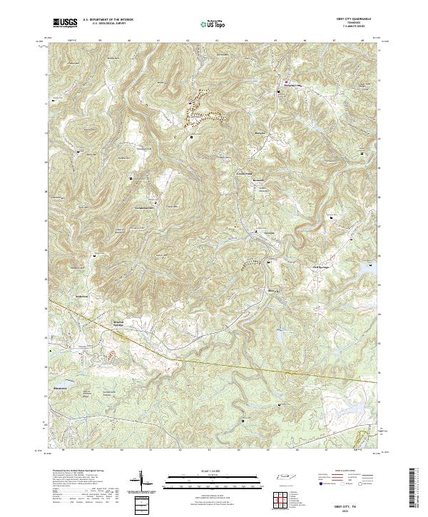
2022 Map of Obey City
USGS Topo · Published 2022About this map
Obey City and its surrounding Highland Rim settlements are depicted here as they sit along the divide between the Overton and Putnam county line. This region of the Cumberland Plateau is defined by a dense network of family cemeteries and small rural centers like Hanging Limb, Cliff Springs, and Green Pond. The map reveals a landscape heavily shaped by its complex topography, where narrow ridges like Laboring Backbone and the Steel Tram Ridge dictate the placement of mountain lanes and homesteads.
Find a feature on this map
146 named features on this map. Tap any name to fly to it.
Don’t see what you’re looking for? This feature index may not catch every label — zoom into the map to look around manually.
Map Details
Editions of this 2022 Obey City Map
This is the sole edition of this map. No revisions or reprints were ever made.
Other maps of this area

1897 · Standingstone
USGS Topo · 1:125,000

1898 · Standingstone
USGS Topo · 1:125,000

1935 · Isoline
USGS Topo · 1:24,000

1935 · Campbell Junction
USGS Topo · 1:24,000

1935 · Clarkrange
USGS Topo · 1:24,000

1943 · Cookeville
USGS Topo · 1:100,000

1944 · Cookeville
USGS Topo · 1:100,000

1946 · Campbell Junction
USGS Topo · 1:24,000
1946 · Isoline
USGS Topo · 1:24,000

1946 · Clarkrange
USGS Topo · 1:24,000