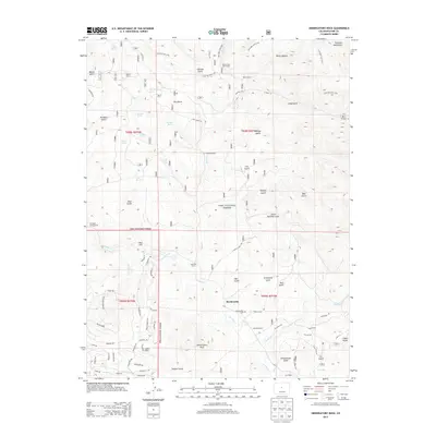
2013 Map of Observatory Rock
USGS Topo · Published 2013About this map
Bordenville and its surrounding ranchlands lie at the heart of this high-altitude landscape within the Pike National Forest. The settlement pattern is defined by historic family-held properties such as the Johnston Ranch, Miller Ranch, and Highfill Ranch, many of which follow the course of Tarryall Cr. A distinct sense of local history is preserved at the Bordenville Cem and in descriptive place names like Schoolhouse Gulch and Graveyard Gulch.
Find a feature on this map
85 named features on this map. Tap any name to fly to it.
Don’t see what you’re looking for? This feature index may not catch every label — zoom into the map to look around manually.
Map Details
Editions of this 2013 Observatory Rock Map
This is the sole edition of this map. No revisions or reprints were ever made.
Other maps of this area
1937 · Como
USGS Topo · 1:62,500
1945 · Shawnee
USGS Topo · 1:24,000
1945 · Mount Logan
USGS Topo · 1:24,000
1948 · Mount Logan
USGS Topo · 1:24,000
1948 · Shawnee
USGS Topo · 1:24,000
1953 · Denver
USGS Topo · 1:250,000
1956 · Eagle Rock
USGS Topo · 1:24,000
1956 · Elkhorn
USGS Topo · 1:24,000
1956 · Farnum Peak
USGS Topo · 1:24,000
1957 · Denver
USGS Topo · 1:250,000