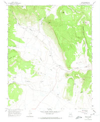
1966 Map of Ocate
USGS Topo · Published 1974About this map
Ocate and its surrounding mountain settlements sit at the confluence of several high-country drainages, including Ocate Creek and LeFebres Creek. The landscape is defined by the massive Gallinas Mesa and the distinct volcanic or erosional forms of Cejita and Cerrito Pelon. For the local historian, the map preserves the locations of several spiritual and community centers, such as the Ocate Mission, Guadalupe Ch, and San Juan Ch, alongside smaller villages like Los LeFebres and Los Huerros. Ranching heritage is evidenced by numerous water features necessary for livestock in this environment, including the La Canada Windmill, Borrego Windmill, and a Flowing Well. Genealogy-rich sites such as Halls Peak Cem and Strong Cem provide specific points of interest for family research within this part of Mora county.
Find a feature on this map
37 named features on this map. Tap any name to fly to it.
Don’t see what you’re looking for? This feature index may not catch every label — zoom into the map to look around manually.
Map Details
Editions of this 1966 Ocate Map
2 editions found
Other maps of this area

1954 · Raton
USGS Topo · 1:250,000

1956 · Tooth Of Time
USGS Topo · 1:62,500

1956 · Miami
USGS Topo · 1:62,500

1958 · Raton
USGS Topo · 1:250,000

1966 · Guadalupita
USGS Topo · 1:24,000
1966 · Lucero
USGS Topo · 1:24,000
1966 · Ojo Feliz
USGS Topo · 1:24,000

1966 · Mora Ranch
USGS Topo · 1:24,000
1966 · Cerro Negro
USGS Topo · 1:24,000

1966 · Ocate
USGS Topo · 1:24,000