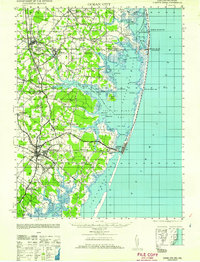
1961 Map of Ocean City
USGS Topo · Published 1961About this map
Ocean City sits at the center of this coastal study, marking a period of transition along the Delmarva shoreline. The landscape is defined by the complex aquatic systems of Little Assawoman Bay, Isle of Wight Bay, and Sinepuxent, protected from the Atlantic Ocean by the narrow barrier islands. Inland, the map reveals the agrarian roots and small-town networks of the late 1940s, featuring settlements like Bishopville, Showell, and Berlin. Maritime history is prominently noted through the Fenwick Island Lighthouse and several life-saving stations, including Isle of Wight LSS and Fenwick Island LSS. Significant changes to the local infrastructure are evident in the marking of the Philadelphia Wilmington and Baltimore RR (Abandoned) and the Baltimore and Virginia RR (Abandoned), tracing the paths of former rail lines that once connected these rural Maryland and Delaware communities.
Find a feature on this map
77 named features on this map. Tap any name to fly to it.
Don’t see what you’re looking for? This feature index may not catch every label — zoom into the map to look around manually.
Map Details
Editions of this 1961 Ocean City Map
This is the sole edition of this map. No revisions or reprints were ever made.
Other maps of this area

1901 · Snow Hill
USGS Topo · 1:62,500

1901 · Green Run
USGS Topo · 1:62,500

1901 · Ocean City
USGS Topo · 1:62,500

1902 · Pittsville
USGS Topo · 1:62,500

1917 · Millsboro
USGS Topo · 1:62,500

1918 · Rehoboth
USGS Topo · 1:62,500

1938 · Millsboro
USGS Topo · 1:62,500

1938 · Rehoboth
USGS Topo · 1:62,500

1938 · Green Run
USGS Topo · 1:62,500

1942 · Ocean City
USGS Topo · 1:62,500