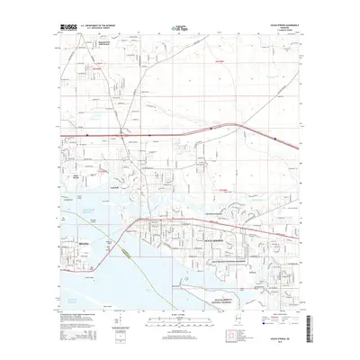
2015 Map of Ocean Springs
USGS Topo · Published 2015About this map
Biloxi and Ocean Springs face each other across the waters of Biloxi Bay, linked by the massive Biloxi Bay Bridge and the Memorial Bridge. This coastal landscape is defined by its complex shoreline, where Old Fort Bayou and St Martin Bayou wind through residential developments like Gulf Hills and Fort Bayou Estates. The map shows a transition from the dense urban grid of the historic harbor areas to the protected natural expanse of the Gulf Islands National Seashore along the southern coastline. Further inland, the map documents the northward expansion of the Gulf Coast community through suburban enclaves such as Martins Pine Hill Estates and Saint Martin, while the Ocean Springs Airport and the historic Antioch Cem serve as prominent local landmarks. Offshore, the long profile of Deer Island provides a natural breakwater for the bay, illustrating the geographic relationship between the mainland settlements and the Gulf of Mexico.
Find a feature on this map
42 named features on this map. Tap any name to fly to it.
Don’t see what you’re looking for? This feature index may not catch every label — zoom into the map to look around manually.
Map Details
Editions of this 2015 Ocean Springs Map
This is the sole edition of this map. No revisions or reprints were ever made.
Other maps of this area

1941 · Vancleave
USGS Topo · 1:62,500

1943 · Pascagoula
USGS Topo · 1:62,500

1943 · Vancleave
USGS Topo · 1:62,500

1944 · Vancleave
USGS Topo · 1:62,500

1953 · Mobile
USGS Topo · 1:250,000

1954 · Vestry
USGS Topo · 1:62,500

1954 · Ocean Springs
USGS Topo · 1:24,000

1954 · Biloxi
USGS Topo · 1:24,000

1954 · Deer Island
USGS Topo · 1:24,000

1954 · Biloxi
USGS Topo · 1:62,500
Featured Places
- Biloxi, MS
- Ocean Springs, MS
- Martins Pine Hill Estates, MS
- Saint Martin, MS
- Fort Bayou Estates, Ocean Springs