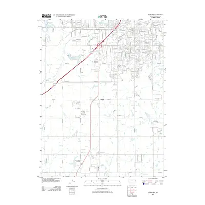
2012 Map of Ocheltree
USGS Topo · Published 2012About this map
Ocheltree and the neighboring settlements of Bonita and Clare sit at the center of this 2012 survey, illustrating the evolving suburban and agricultural character of Johnson County. The landscape is defined by its water management and recreation, featuring significant reservoirs such as Olathe Lake, New Olathe Lake, and Spring Hill City Lake. These water bodies, along with numerous ponds like the Olathe East High School Pond, are integrated into a network of drainage including Wolf Cr and Cedar Cr. This era shows a transition from rural farmland toward organized suburban development and specialized land use, evidenced by the Clear View Farm Airport and sprawling recreational sites like Wolf Creek Golf Links and Sycamore Ridge Golf Course. Traditional local landmarks remain prominent, such as the Mount Calvary Catholic Cem, providing a grounded sense of history amidst the modernizing infrastructure and residential street grids expanding southward.
Find a feature on this map
155 named features on this map. Tap any name to fly to it.
Don’t see what you’re looking for? This feature index may not catch every label — zoom into the map to look around manually.
Map Details
Editions of this 2012 Ocheltree Map
This is the sole edition of this map. No revisions or reprints were ever made.
Other maps of this area

1887 · Olathe
USGS Topo · 1:125,000

1893 · Olathe
USGS Topo · 1:125,000

1935 · Olathe
USGS Topo · 1:24,000

1935 · Lenexa
USGS Topo · 1:24,000

1943 · Lenexa
USGS Topo · 1:31,680

1943 · Olathe
USGS Topo · 1:31,680

1947 · Lawrence
USGS Topo · 1:250,000

1950 · Lawrence
USGS Topo · 1:250,000

1951 · De Soto
USGS Topo · 1:24,000

1956 · Stilwell
USGS Topo · 1:24,000