
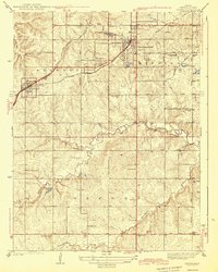
1943 Map of Lenexa
USGS Topo · Published 1943About this map
Lenexa and Overland Park serve as the primary hubs in this Johnson County landscape, which was surveyed shortly before the United States entered World War II. The map reveals a transition from the structured street grids of developing townships into a rural interior defined by independent school districts and family landmarks. Transportation defines the region's movement, with the St Louis and San Francisco RR and the Missouri and Kansas Electric RR cutting across the terrain toward Kansas City.
Find a feature on this map
46 named features on this map. Tap any name to fly to it.
Don’t see what you’re looking for? This feature index may not catch every label — zoom into the map to look around manually.
Map Details
Editions of this 1943 Lenexa Map
2 editions found
Other maps of this area

1887 · Olathe
USGS Topo · 1:125,000

1890 · Kansas City
USGS Topo · 1:125,000

1893 · Olathe
USGS Topo · 1:125,000

1894 · Kansas City
USGS Topo · 1:125,000

1934 · Bonner Springs
USGS Topo · 1:48,000

1934 · Grandview
USGS Topo · 1:24,000

1934 · Shawnee
USGS Topo · 1:24,000

1934 · Edwardsville
USGS Topo · 1:24,000

1935 · Olathe
USGS Topo · 1:24,000

1935 · Kansas City
USGS Topo · 1:24,000