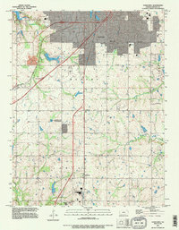
1991 Map of Ocheltree
USGS Topo · Published 1996About this map
Ocheltree and its surrounding Johnson County landscape appear in high detail during the early 1990s, caught between established agriculture and the expanding urban footprint of Olathe. The map documents a corridor of small settlements along the rail lines and highways, including Clare, Bonita, and Spring Hill. Water resources are prominent features of the terrain, with the bifurcated Olathe Lake and the larger New Olathe Lake situated along Cedar Creek.
Find a feature on this map
25 named features on this map. Tap any name to fly to it.
Don’t see what you’re looking for? This feature index may not catch every label — zoom into the map to look around manually.
Map Details
Editions of this 1991 Ocheltree Map
This is the sole edition of this map. No revisions or reprints were ever made.
Other maps of this area

1887 · Olathe
USGS Topo · 1:125,000

1893 · Olathe
USGS Topo · 1:125,000

1935 · Olathe
USGS Topo · 1:24,000

1935 · Lenexa
USGS Topo · 1:24,000

1943 · Lenexa
USGS Topo · 1:31,680

1943 · Olathe
USGS Topo · 1:31,680

1947 · Lawrence
USGS Topo · 1:250,000

1950 · Lawrence
USGS Topo · 1:250,000

1951 · De Soto
USGS Topo · 1:24,000

1956 · Stilwell
USGS Topo · 1:24,000