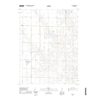
2021 Map of Oconee
USGS Topo · Published 2021About this map
Oconee and the southern outskirts of Pana anchor this landscape along the border of Christian and Shelby counties. The area is defined by a dendritic network of waterways including Coal Creek, Becks Creek, and Matney Branch that carve through the prairie terrain. Significant water features like Lake Pana, Paragon Lake, and Boy Scout Lake dominate the northern sections, while the southern reaches remain predominantly agricultural. Local heritage is preserved in several burial sites including Oconee Mound Cemetery, Sacred Heart Cemetery, and Coal Creek Cemetery. The rural road network, including County Highway 14 and Old Turkey Farm Road, provides a framework for the scattered farmsteads and small-town blocks that characterize this part of central Illinois.
Find a feature on this map
41 named features on this map. Tap any name to fly to it.
Don’t see what you’re looking for? This feature index may not catch every label — zoom into the map to look around manually.
Map Details
Editions of this 2021 Oconee Map
This is the sole edition of this map. No revisions or reprints were ever made.
Other maps of this area

1941 · St. Elmo
USGS Topo · 1:62,500

1942 · Shelbyville
USGS Topo · 1:62,500

1944 · Ramsey
USGS Topo · 1:62,500

1945 · St. Elmo
USGS Topo · 1:62,500

1946 · Shelbyville
USGS Topo · 1:62,500

1946 · Ramsey
USGS Topo · 1:62,500

1947 · Pana
USGS Topo · 1:62,500

1949 · Pana
USGS Topo · 1:62,500

1958 · Decatur
USGS Topo · 1:250,000

1961 · Decatur
USGS Topo · 1:250,000