2024 Map of Oconee
USGS Topo · Published 2024About this map
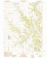
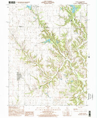
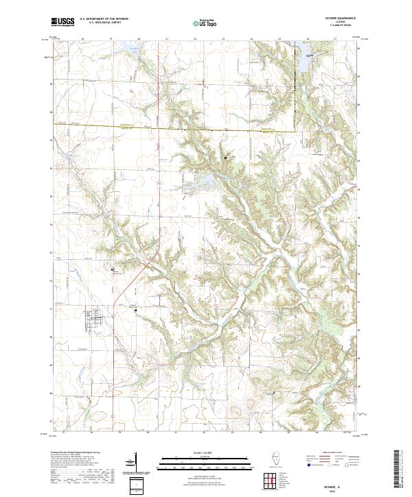
Oconee serves as the primary hub of this landscape where the borders of Shelby and Christian counties meet. The terrain is defined by the intricate dendritic drainage patterns of Coal Creek and Becks Creek, which carve through the central and eastern portions of the quadrangle. These waterways create a distinct contrast between the flat upland agricultural fields and the wooded breaks surrounding Opossum Creek and Matney Branch. Local heritage is anchored by several rural burial sites, including the Oconee Mound Cem and Sacred Heart Cem, which reflect the area's long-standing community foundations. Small water bodies like Paragon Lake and Boy Scout Lake dot the northern reaches, while the southern edge of Pana enters the frame at the top right. A dense grid of rural routes, including Old Turkey Farm Rd, facilitates access to these interior drainage basins and secluded lakefronts.
Find a feature on this map
62 named features on this map. Tap any name to fly to it.
Don’t see what you’re looking for? This feature index may not catch every label — zoom into the map to look around manually.
Map Details
Editions of this 2024 Oconee Map
This is the sole edition of this map. No revisions or reprints were ever made.