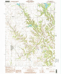
1998 Map of Oconee
USGS Topo · Published 2002About this map
Oconee and Herrick anchor this landscape along the border of Christian and Shelby counties, where the prairie meets the intricate drainage systems of the upper Kaskaskia River watershed. The terrain is defined by the winding paths of Becks Creek and Opossum Creek, which have carved deep valleys into the local topography, contrasting sharply with the flatter surveying grids used for farming. Notable for genealogists and local historians, the map identifies several rural landmarks including the Hopewell Ch and Sacred Heart Cem, along with the Price Cem located further east. To the north, the waters of Lake Pana and Paragon L provide a significant geographical boundary, while the prominent elevation of Oconee Mound rises near the village of the same name. An Abandoned railroad corridor cutting through the western sections serves as a silent witness to the area's former transportation network and rail-based economy.
Find a feature on this map
22 named features on this map. Tap any name to fly to it.
Don’t see what you’re looking for? This feature index may not catch every label — zoom into the map to look around manually.
Map Details
Editions of this 1998 Oconee Map
This is the sole edition of this map. No revisions or reprints were ever made.
Other maps of this area

1941 · St. Elmo
USGS Topo · 1:62,500

1942 · Shelbyville
USGS Topo · 1:62,500

1944 · Ramsey
USGS Topo · 1:62,500

1945 · St. Elmo
USGS Topo · 1:62,500

1946 · Shelbyville
USGS Topo · 1:62,500

1946 · Ramsey
USGS Topo · 1:62,500

1947 · Pana
USGS Topo · 1:62,500

1949 · Pana
USGS Topo · 1:62,500

1958 · Decatur
USGS Topo · 1:250,000

1961 · Decatur
USGS Topo · 1:250,000