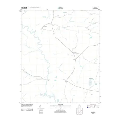
2011 Map of Oconee
USGS Topo · Published 2011About this map
The Oconee River meanders through Washington County, defining the western landscape of this Georgia quadrangle. The namesake settlement of Oconee sits near the riverbanks, serving as a focal point for a network of rural roads such as Ohoopee Church Rd and Cox Town Rd. Nearby, the community of Gardner is situated along the river's eastern bend, while the settlement of Veal occupies the southern reaches of the map.
Find a feature on this map
53 named features on this map. Tap any name to fly to it.
Don’t see what you’re looking for? This feature index may not catch every label — zoom into the map to look around manually.
Map Details
Editions of this 2011 Oconee Map
This is the sole edition of this map. No revisions or reprints were ever made.
Other maps of this area

1916 · Irwinton
USGS Topo · 1:62,500

1920 · Irwinton
USGS Topo · 1:62,500

1957 · Macon
USGS Topo · 1:250,000

1958 · Macon
USGS Topo · 1:250,000

1962 · Oconee
USGS Topo · 1:24,000

1962 · Irwins Crossroads
USGS Topo · 1:24,000

1962 · Tabernacle
USGS Topo · 1:24,000

1962 · Sandersville
USGS Topo · 1:24,000

1964 · Macon
USGS Topo · 1:250,000
1973 · Toomsboro
USGS Topo · 1:24,000