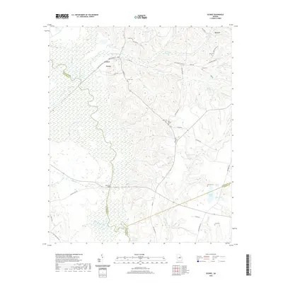
2020 Map of Oconee
USGS Topo · Published 2020About this map
The Oconee River and its intricate swamp systems dominate this portion of Washington County, where the river serves as the long-standing boundary with Wilkinson County to the west. The settlement of Oconee and nearby Gardner sit along the high ground north of the extensive wetlands formed by the confluence of Commissioner Cr, Buckhorn Br, and Ochee Cr. This topography dictated the placement of local infrastructure, forcing roads like Old Balls Ferry Rd to navigate the fringes of the Dead River oxbows toward the Balls Ferry Bridge.
Find a feature on this map
63 named features on this map. Tap any name to fly to it.
Don’t see what you’re looking for? This feature index may not catch every label — zoom into the map to look around manually.
Map Details
Editions of this 2020 Oconee Map
This is the sole edition of this map. No revisions or reprints were ever made.
Other maps of this area

1916 · Irwinton
USGS Topo · 1:62,500

1920 · Irwinton
USGS Topo · 1:62,500

1957 · Macon
USGS Topo · 1:250,000

1958 · Macon
USGS Topo · 1:250,000

1962 · Oconee
USGS Topo · 1:24,000

1962 · Irwins Crossroads
USGS Topo · 1:24,000

1962 · Tabernacle
USGS Topo · 1:24,000

1962 · Sandersville
USGS Topo · 1:24,000

1964 · Macon
USGS Topo · 1:250,000
1973 · Toomsboro
USGS Topo · 1:24,000