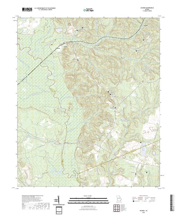
2024 Map of Oconee
USGS Topo · Published 2024About this map
The Oconee River carves a winding path through the center of this Georgia landscape, defining the boundaries of Washington, Wilkinson, and Johnson counties. Near the northern bend, the settlement of Oconee and neighboring Gardner sit along a network of local roads including Kaolin Ln, hinting at the region's industrial connection to clay mining. Further south, the historic crossing at Balls Ferry marks a significant point where Oochee Creek meets the river's floodplain.
Find a feature on this map
64 named features on this map. Tap any name to fly to it.
Don’t see what you’re looking for? This feature index may not catch every label — zoom into the map to look around manually.
Map Details
Editions of this 2024 Oconee Map
This is the sole edition of this map. No revisions or reprints were ever made.
Other maps of this area

1916 · Irwinton
USGS Topo · 1:62,500

1920 · Irwinton
USGS Topo · 1:62,500

1957 · Macon
USGS Topo · 1:250,000

1958 · Macon
USGS Topo · 1:250,000

1962 · Oconee
USGS Topo · 1:24,000

1962 · Irwins Crossroads
USGS Topo · 1:24,000

1962 · Tabernacle
USGS Topo · 1:24,000

1962 · Sandersville
USGS Topo · 1:24,000

1964 · Macon
USGS Topo · 1:250,000
1973 · Toomsboro
USGS Topo · 1:24,000