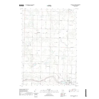
2018 Map of Oconto Falls North
USGS Topo · Published 2018About this map
Oconto Falls serves as the southern anchor for this section of Oconto County, situated where the Oconto River widens into the Oconto Falls Pond. The landscape north of the city is characterized by a dense network of glacial lakes and wetlands, including Balcom Lake, Kuplic Lake, and Johnson Lake. These water bodies are connected by a rural road system that links small farming communities like Kelly Brook and Spruce. Local history and genealogy are well-represented by several established burial grounds, such as Saint Mark Cem, Pine Hill Cem, and Sacred Heart Cem, which often indicate the sites of early parish settlements. The map shows a clear transition from the industrial and residential core of Oconto Falls to the open acreage and seasonal lake properties of the Wisconsin Northwoods.
Find a feature on this map
56 named features on this map. Tap any name to fly to it.
Don’t see what you’re looking for? This feature index may not catch every label — zoom into the map to look around manually.
Map Details
Editions of this 2018 Oconto Falls North Map
This is the sole edition of this map. No revisions or reprints were ever made.
Other maps of this area

1941 · Coleman
USGS Topo · 1:48,000

1942 · Coleman
USGS Topo · 1:48,000

1942 · Breed
USGS Topo · 1:48,000

1950 · Coleman
USGS Topo · 1:48,000

1952 · Mountain
USGS Topo · 1:48,000

1954 · Iron Mountain
USGS Topo · 1:250,000

1955 · Green Bay
USGS Topo · 1:250,000

1956 · Gillett
USGS Topo · 1:62,500

1956 · Oconto Falls
USGS Topo · 1:62,500

1959 · Iron Mountain
USGS Topo · 1:250,000