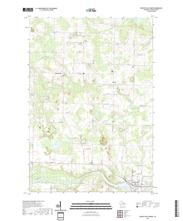
2022 Map of Oconto Falls North
USGS Topo · Published 2022About this map
Oconto Falls sits along the southern edge of this landscape, where the Oconto River widens into the Oconto Falls Pond. The area is characterized by a high density of small lakes and wetlands, including Kuplic Lake, Lily Lake, and Balcom Lake, interspersed with a network of rural roads that often follow early township lines. For genealogists, the map identifies several distinct burial grounds such as Kelly Brook Cem, Saint Mark Cem, and Pine Hill Cem near the small settlement of Spruce. The presence of numerous family-named roads like Steffel Rd and Ankerson Rd suggests a community where generational family farms and landholdings have maintained a consistent presence despite the shifting boundaries of the t29n r19e and t28n r19e survey townships.
Find a feature on this map
59 named features on this map. Tap any name to fly to it.
Don’t see what you’re looking for? This feature index may not catch every label — zoom into the map to look around manually.
Map Details
Editions of this 2022 Oconto Falls North Map
This is the sole edition of this map. No revisions or reprints were ever made.
Other maps of this area

1941 · Coleman
USGS Topo · 1:48,000

1942 · Coleman
USGS Topo · 1:48,000

1942 · Breed
USGS Topo · 1:48,000

1950 · Coleman
USGS Topo · 1:48,000

1952 · Mountain
USGS Topo · 1:48,000

1954 · Iron Mountain
USGS Topo · 1:250,000

1955 · Green Bay
USGS Topo · 1:250,000

1956 · Gillett
USGS Topo · 1:62,500

1956 · Oconto Falls
USGS Topo · 1:62,500

1959 · Iron Mountain
USGS Topo · 1:250,000