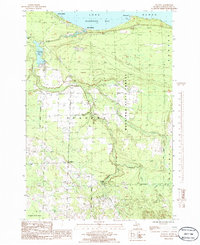
1986 Map of Ocqueoc
USGS Topo · Published 1986About this map
Hammond Bay defines the northern edge of this coastal landscape along Lake Huron, where the Ocqueoc River meets the shore at Bell Landing. This 1980s survey illustrates a region largely shaped by the Mackinaw State Forest and the interior drainage of the Ocqueoc River system, which flows through Ocqueoc Lake before reaching the lake. The terrain is marked by significant natural landmarks, most notably Ocqueoc Falls and its adjacent Campground near the southern boundary. Settlement is concentrated along the shoreline at Huron Beach and inland at the small community of Ocqueoc. Evidence of local industry and infrastructure is visible in scattered Gravel Pits and a rural Cem, reflecting a quiet, resource-based economy in Presque Isle County. Tributaries like Silver Creek and Indian Creek carve through the forest, showing the intricate hydrology of the Ocqueoc and Moltke townships.
Find a feature on this map
18 named features on this map. Tap any name to fly to it.
Don’t see what you’re looking for? This feature index may not catch every label — zoom into the map to look around manually.
Map Details
Editions of this 1986 Ocqueoc Map
This is the sole edition of this map. No revisions or reprints were ever made.
Other maps of this area

1954 · Alpena
USGS Topo · 1:250,000

1955 · Cheboygan
USGS Topo · 1:250,000

1957 · Alpena
USGS Topo · 1:250,000

1957 · Onaway
USGS Topo · 1:62,500

1958 · Cheboygan
USGS Topo · 1:250,000

1958 · Alpena
USGS Topo · 1:250,000

1958 · Grace
USGS Topo · 1:62,500

1969 · Alpena
USGS Topo · 1:250,000

1971 · Hawks
USGS Topo · 1:24,000
1971 · Moltke
USGS Topo · 1:24,000