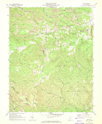
1968 Map of Odd
USGS Topo · Published 1972About this map
Guyandotte Mountain and Flat Top Mountain dominate this late 1960s survey of southern Raleigh and northern Mercer counties. The landscape is defined by the heavy footprint of the coal industry, where prominent strip mines and a large mine dump near Josephine mark the ridges above Piney Creek. This area illustrates the specialized geography of the West Virginia coalfields, where small, isolated settlements like Odd and Willibet are connected by winding mountain roads and the newer corridor of the West Virginia Turnpike. In the southern portion of the sheet, the industrial character gives way to the protected woods of Camp Creek State Forest. Local genealogy and community history are anchored by several rural landmarks, including Mountain Valley Ch, Egeria Ch, and family-named terrain like Indian Grave Mtn and Barkers Ridge.
Find a feature on this map
62 named features on this map. Tap any name to fly to it.
Don’t see what you’re looking for? This feature index may not catch every label — zoom into the map to look around manually.
Map Details
Editions of this 1968 Odd Map
2 editions found
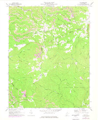
Other maps of this area

1887 · Pocahontas
USGS Topo · 1:125,000

1891 · Pocahontas
USGS Topo · 1:125,000

1891 · Raleigh
USGS Topo · 1:125,000

1894 · Pocahontas
USGS Topo · 1:125,000

1895 · Pocahontas
USGS Topo · 1:125,000

1897 · Raleigh
USGS Topo · 1:125,000

1902 · Raleigh
USGS Topo · 1:125,000

1909 · Pocahontas Special
USGS Topo · 1:48,000

1911 · Flattop
USGS Topo · 1:48,000

1911 · Pocahontas Special
USGS Topo · 1:62,500