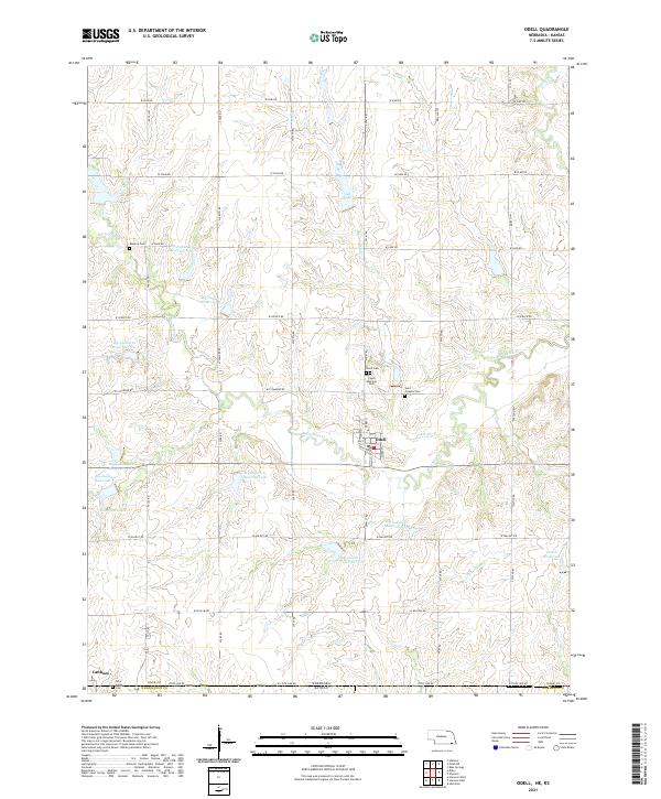
2021 Map of Odell
USGS Topo · Published 2021About this map
The village of Odell serves as the central hub of this agricultural landscape in southern Gage County, Nebraska. A network of country roads, including W Sage Rd and W Walnut Rd, divides the terrain into systematic sections typical of the Great Plains. The map reveals a dense concentration of local heritage sites concentrated around the settlement, including the Odell Cem, the Czech National Cem, and Saint Josephs Cem. To the southwest, the border community of Lanham sits directly on the State Line Rd at the boundary with Washington County, Kansas.
Find a feature on this map
57 named features on this map. Tap any name to fly to it.
Don’t see what you’re looking for? This feature index may not catch every label — zoom into the map to look around manually.
Map Details
Editions of this 2021 Odell Map
This is the sole edition of this map. No revisions or reprints were ever made.
Other maps of this area

1889 · Marysville
USGS Topo · 1:125,000

1894 · Marysville
USGS Topo · 1:125,000

1955 · Manhattan
USGS Topo · 1:250,000

1955 · Lincoln
USGS Topo · 1:250,000

1956 · Manhattan
USGS Topo · 1:250,000

1957 · Manhattan
USGS Topo · 1:250,000

1957 · Lincoln
USGS Topo · 1:250,000

1958 · Lincoln
USGS Topo · 1:250,000

1964 · Blue Springs
USGS Topo · 1:24,000
1966 · Herkimer
USGS Topo · 1:24,000