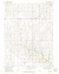
1970 Map of Odell NE
USGS Topo · Published 1972About this map
The Chicago Rock Island and Pacific railroad cuts a definitive east-west line through the northern reaches of this Gage County landscape, connecting the small settlement of Ellis with the larger community of Beatrice at the northeastern corner. This 1970 field-checked survey reveals a rural landscape deeply defined by its drainage systems, where the winding courses of Sicily Creek and Bottle Creek create a complex topography of ridges and draws across the townships of Lincoln, Riverside, Sicily, and Elm. For those tracing local heritage, the map identifies specific points of community rest and recreation, such as Ellis Cem, Pleasant Hill Cem, and the Hidden Acres Country Club. Modern infrastructure, including a prominent network of Pipelines and several Radio Towers, exists alongside traditional agricultural features like a Sandpit and scattered wells, documenting the evolution of land use in southeastern Nebraska.
Find a feature on this map
19 named features on this map. Tap any name to fly to it.
Don’t see what you’re looking for? This feature index may not catch every label — zoom into the map to look around manually.
Map Details
Editions of this 1970 Odell NE Map
2 editions found
Other maps of this area

1955 · Lincoln
USGS Topo · 1:250,000

1957 · Lincoln
USGS Topo · 1:250,000

1957 · Plymouth
USGS Topo · 1:24,000

1957 · Beatrice West
USGS Topo · 1:24,000

1957 · Beatrice East
USGS Topo · 1:24,000

1958 · Lincoln
USGS Topo · 1:250,000

1964 · Blue Springs
USGS Topo · 1:24,000

1970 · Diller NE
USGS Topo · 1:24,000
1970 · Wymore
USGS Topo · 1:24,000
1970 · Harbine
USGS Topo · 1:24,000