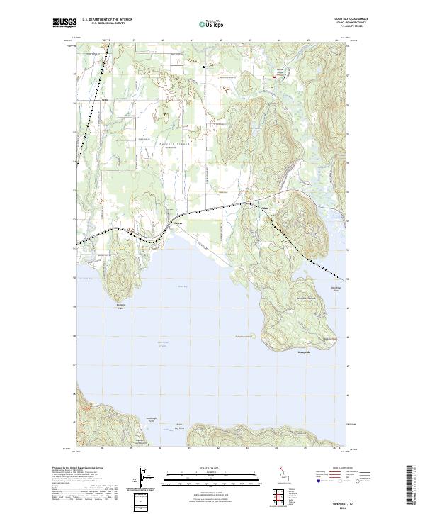
2024 Map of Oden Bay
USGS Topo · Published 2024About this map
Lake Pend Oreille dominates the southern landscape of this Idaho quadrangle, where the waters of Oden Bay and Bottle Bay meet a complex shoreline of points and inlets. The terrain transitions from the low-lying Purcell Trench in the west to the rising slopes of the Cabinet Mountains in the east, with Sunnyside Mountain standing as a prominent local landmark. This 2024 survey captures the rural character of the area, defined by small settlements like Oden, Culver, and Sunnyside that are connected by a network of local roads such as Sunnyside Rd and Selle Rd.
Find a feature on this map
89 named features on this map. Tap any name to fly to it.
Don’t see what you’re looking for? This feature index may not catch every label — zoom into the map to look around manually.
Map Details
Editions of this 2024 Oden Bay Map
This is the sole edition of this map. No revisions or reprints were ever made.
Other maps of this area

1901 · Sandpoint
USGS Topo · 1:125,000

1911 · Priest Lake
USGS Topo · 1:250,000

1911 · Sandpoint
USGS Topo · 1:125,000

1913 · Priest Lake
USGS Topo · 1:250,000

1949 · Packsaddle Mtn
USGS Topo · 1:62,500

1951 · Packsaddle Mtn
USGS Topo · 1:62,500

1951 · Elmira
USGS Topo · 1:62,500

1958 · Sandpoint
USGS Topo · 1:250,000

1963 · Sandpoint
USGS Topo · 1:250,000
1968 · Colburn
USGS Topo · 1:24,000