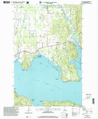
1996 Map of Oden Bay
USGS Topo · Published 1999About this map
Lake Pend Oreille dominates this mid-1990s landscape where the Pack River and Lightning Creek meet the shoreline. The map illustrates a transitional rural environment near the Kaniksu National Forest boundary, characterized by localized settlements like Selle and Culver. Public resources and community landmarks are clearly marked, including the North Side School and Pack River Cemetery, while the northern portion of the lake features the Pend Oreille State Wildlife Management Area and the extensive Pack River Flats.
Find a feature on this map
37 named features on this map. Tap any name to fly to it.
Don’t see what you’re looking for? This feature index may not catch every label — zoom into the map to look around manually.
Map Details
Editions of this 1996 Oden Bay Map
This is the sole edition of this map. No revisions or reprints were ever made.
Other maps of this area

1901 · Sandpoint
USGS Topo · 1:125,000

1911 · Priest Lake
USGS Topo · 1:250,000

1911 · Sandpoint
USGS Topo · 1:125,000

1913 · Priest Lake
USGS Topo · 1:250,000

1949 · Packsaddle Mtn
USGS Topo · 1:62,500

1951 · Packsaddle Mtn
USGS Topo · 1:62,500

1951 · Elmira
USGS Topo · 1:62,500

1958 · Sandpoint
USGS Topo · 1:250,000

1963 · Sandpoint
USGS Topo · 1:250,000
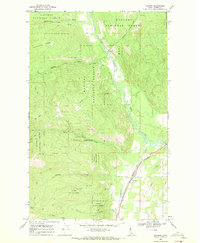
1968 · Colburn
USGS Topo · 1:24,000