
1964 Map of Odessa NW
USGS Topo · Published 1966About this map
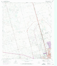
Odessa expands northward across the West Texas Permian Basin in the mid-1960s, its urban development following a rigid grid of streets like 52nd St and Golder Road. The landscape is dominated by the petroleum industry, with the North Cowden Oil Field, Johnson Oil Field, and Foster Oil Field blanketing the terrain in a dense network of pipelines, aqueducts, and named water sources like Willow Well and Mexican Well. Local civic life is centered around institutions such as Goliad Sch and the Greenfield Ch, while recreational features like a Drive-in Theater, Racetrack, and a Golf Course mark the city's suburban fringes. The presence of the County Airport and a dedicated Filtration Plant highlights the infrastructure required to support this rapidly growing oil-rich region.
Find a feature on this map
49 named features on this map. Tap any name to fly to it.
Don’t see what you’re looking for? This feature index may not catch every label — zoom into the map to look around manually.
Map Details
Editions of this 1964 Odessa NW Map
4 editions found
Other maps of this area

1954 · Hobbs
USGS Topo · 1:250,000

1954 · Pecos
USGS Topo · 1:250,000

1957 · Pecos
USGS Topo · 1:250,000

1958 · Hobbs
USGS Topo · 1:250,000

1964 · Odessa NE
USGS Topo · 1:24,000

1964 · Odessa SW
USGS Topo · 1:24,000

1964 · Odessa SE
USGS Topo · 1:24,000

1964 · Douro
USGS Topo · 1:24,000

1965 · Goldsmith
USGS Topo · 1:24,000

1967 · North Cowden
USGS Topo · 1:24,000